
Astrium GEO-Information services (before called Infoterra) and Arvalis-Institut du Végétal companies have carried this project since 2002.
The main beneficiaries are the farmers but also the soil production.
In 2009, around 8,000 farmers used FARMSTAR on a total surface of 400.000 acres of land, essentially for corn, wheat, barley and rapeseed.
FARMSTAR allows direct savings on inputs thanks to a precise diagnosis of needs. Farmers optimize the quantities of fertilizers, with an identical or even better yield. Financially, this represents an average saving of 10 to 20 € per hectare. The increase in the price of inputs increases this saving.
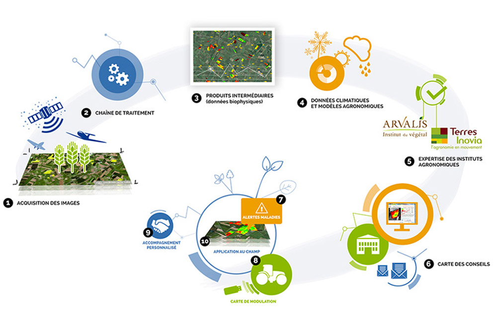
The value proposition of Farmstar is helping farmers in two ways. The first objective is to make them profitable. To do so, the company offers high-resolution images, captured by satellites called SPOT Image, in order to increase yield and quality of crops. Thanks to two different types of sources which are “bottom-up model” and “top-down observations, respectively from agronomic expertise and aerospace technology, Farmstar's attributes of the service can deliver four different components.
The first service can assess situations of disease and lodging thanks to the monitoring of crop, soil, and climate. The second service provides recommendations toward the density, the quantity of fertilizer and other element needed with a decision support system.
These two services are collecting information about crop from remote data. This competency can be used thanks to Arvalis and Matra Marconi Space organization.
The third service is an attribute mapping collecting information on the plant physiology (leaves density and chlorophyll contents) to understand the status of the crop. Cetium and ITB organizations enable the extension of knowledge about the plant physiology.
The fourth is a spatial referencing using GPS to analyze yields and its dimensions (crop yield).This method corresponds the the SPOT Imagery competency that can from Centre Nationale D’Etudes Spatiale and used later by EADS-Astrium
Home Page